
Teruiaiken Fm
Type Locality and Naming
Kuruktag region. The Teruiaiken Fm was named by E. Norin (1937). The type section is located between the Teruiaiken Gully and the Beiyixi Gully in Kurktag west of the Yuli County, Xinjiang Weiwuerzhu Zizhiqu (Xinjiang Uygur Autonomous Region). The main reference section is located in Zhaobishan of the middle part of Kurktag, south slope of Xinggertag and Yulegunbulak, Xinjiang Weiwuerzhu Zizhiqu (Xinjiang Uygur Autonomous Region). Middle formation of the Kuruktag Gr (5 of 9).
Synonym: (特瑞爱肯组)
Lithology and Thickness
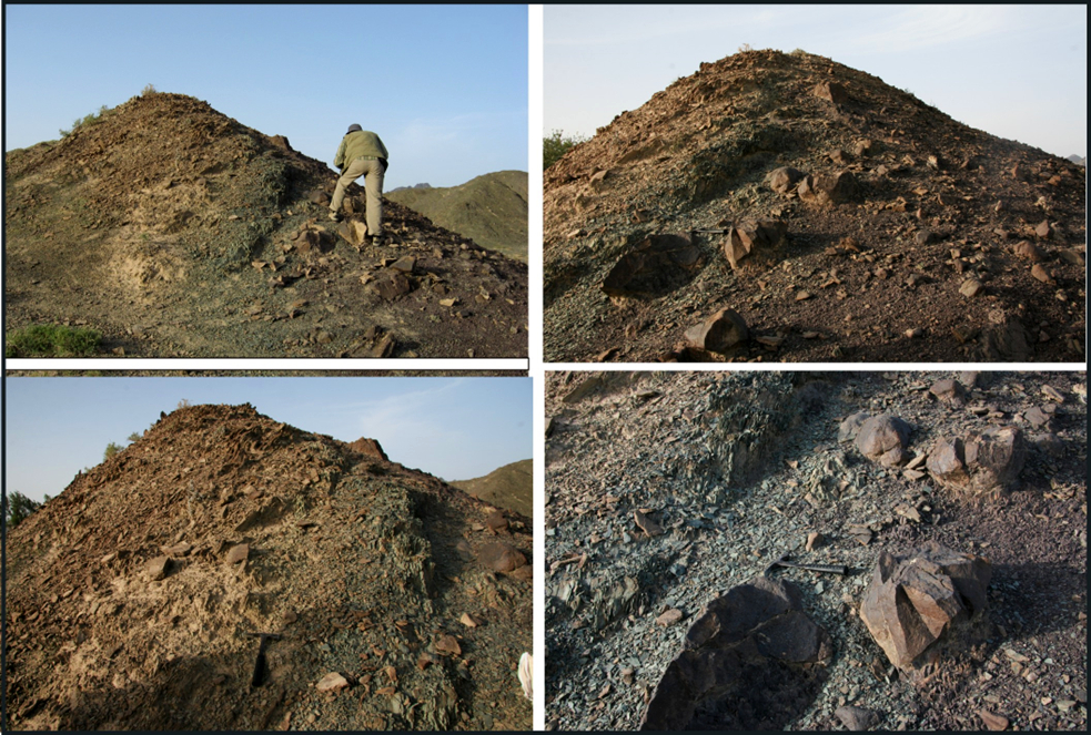
The Teruiaiken Fm consists mainly of gray, dark gray and gray-green massive diamictite (tillite), gray-purple locally. The diamictite shows no bedded and unsorted, with pebbles in different sizes. Striated, indentation and chatter-marks are usually found on the pebble surface. In upper part of the formation, it is interbedded with thin-bedded gray-green silty slate and siltstone and argillite (laminated slate), sometimes interbedded with sandstone or tuffaceous sandstone and dolomitic limestone lenses (some geologists believe that the dolomite is a carbonate cap developed in the top part of the tillite). Following the trend of the massive diamictite (tillite) is usually changed to thin-bedded slate and siltstone with pebbles or sandstone. The thickness changes a lot, which is from 440 to 1850 m and shows that thickness changes quickly in short distance. The formation is 1733 m thick in Teruiaiken of the west of Kurugtag and Xishankou. It is 1845 m thick when going east to Zhaobishan in middle Kuruktag. It is only 441 m thick going south to the north of Xingditag (the Aletonggou Formation is changed to 21.7 m thick); it is 617 m thick in Yardang Mountain.
[Figure: Type section of the Teruiaiken Fm]
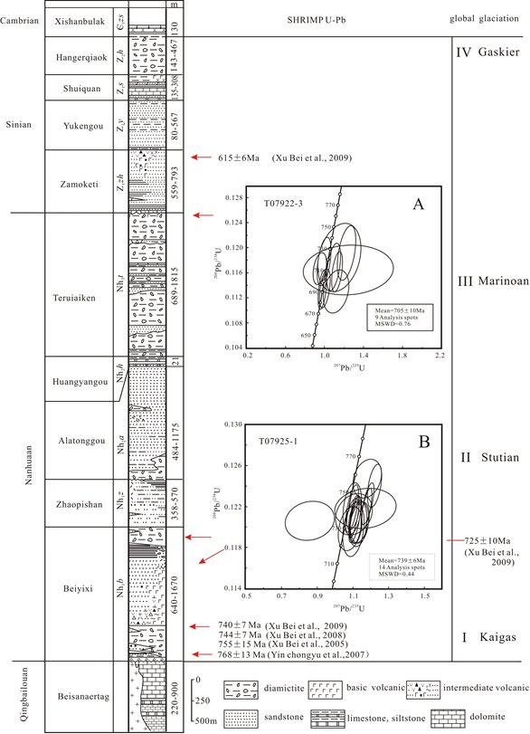
[Figure: Stratigraphic Column of the Kuruktag Gr]
Relationships and Distribution
Lower contact
The formation is conformable onto the underlying Aletonggou Fm and shows a facies boundary between them. The thick massive tillite (diamictite) is taken as the basal boundary. However, in some locations according to the stratigraphic column, there is an intervening Huangyanggou Fm of interglacial limestone below the tillite unless scoured away.
Upper contact
The upper part of the formation is unconformable or disconformable with the overlying Zhamokti Fm
Regional extent
Kuruktag region. The formation is widely distributed from west of Teruiaiken of Kalatiekenwula Mountains in Korla, eastward to Xishankou, Zhaobishan, Xinggertag, and Yardang Mountain north and south of Xingditag and intermittently to Yulegunbulak south of Shanshan County of the east Kuruktag.
GeoJSON
Fossils
Microplants found in the thin-bedded argillite within the tillite and in interbeds of siltstone are Trachysphaeridium cultum, T. hyalinum, Pseudozono- Sphaera asperella, P. verrucosa etc.
Age
Depositional setting
Additional Information
Some geologists consider the Teruiaiken Formation, together with underlying Aletonggou Formation, as the product of the same ice age, with only different environments and resulting different lithologies. However, some geologists oppose such a glacial origin, and consider it to be gravity flow deposits.